 vesseltracker.com
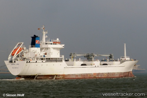
 Sierra Lara
Current Status
Where is the vessel?
Sierra Lara is currently in Near Dalia, based on AIS data received less than 1h ago.
Latest AIS update:
Current position: 7.56358° S, 11.86511° E (Near Dalia)
Average speed (last 7 days): Loading…
Average speed (last 30 days): Loading…
Vessel profile: Sierra Lara is a Refrigerated Cargo Ship with dimensions 117m x 17m.
This page combines live AIS, route history, probable destination signals, nearby traffic, and port activity for practical vessel monitoring.
The current position of vessel Sierra Lara is -7.56358 lat / 11.86511 lng. Updated: 2026-04-20 00:15:41 UTCNearest reference points:
- Near Greater Plutonio
- Near SOYO
- Near Luanda
Currently sailing under the flag of Bahamas ![]()
Sierra Lara built in 1996 year
Deadweight:
5970 tDetails:
Live Vessel Sierra Lara Analytics (details, animations, etc.)
Recent AIS points (UTC):
2026-04-19 19:52:23 UTC · -8.39086, 11.86886 · SOG 11 kn · COG 8°2026-04-19 21:39:03 UTC · -8.05517, 11.90503 · SOG 11.3 kn · COG 8°
2026-04-19 22:30:52 UTC · -7.89013, 11.92267 · SOG 11.1 kn · COG 8°
2026-04-20 00:15:41 UTC · -7.56358, 11.86511 · SOG 11.8 kn · COG 6°