 MAKRA
MAKRA
Current Status
Where is the vessel?
MAKRA is currently in Near ZAANDAM, based on AIS data received about 14h ago.
Latest AIS update:
Current position: 52.40036° N, 4.85853° E (Near ZAANDAM)
Average speed (last 7 days): Loading…
Average speed (last 30 days): Loading…
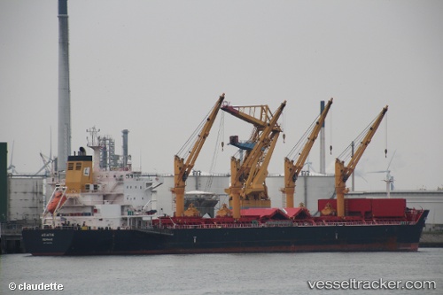
Vessel profile: MAKRA is a Bulk Carrier with dimensions 196m x 32m.
This page combines live AIS, route history, probable destination signals, nearby traffic, and port activity for practical vessel monitoring.
The current position of vessel MAKRA is 52.40036 lat / 4.85853 lng. Updated: 2026-05-23 22:24:08 UTCNearest reference points:
- Near ZAANDAM
- Near Amsterdam
- Near Zaanstad
Currently sailing under the flag of Bahamas ![]()
MAKRA built in 2012 year
Deadweight:
58451 tDetails:
Live Vessel MAKRA Analytics (details, animations, etc.)
Recent AIS points (UTC):
2026-05-23 17:41:57 UTC · 52.40035, 4.85847 · SOG 0 kn · COG 125°2026-05-23 20:02:16 UTC · 52.40035, 4.85852 · SOG 0.1 kn · COG 125°
2026-05-23 20:21:24 UTC · 52.40039, 4.85855 · SOG 0.1 kn · COG 125°
2026-05-23 22:24:08 UTC · 52.40036, 4.85853 · SOG 0.1 kn · COG 125°