 vesseltracker.com
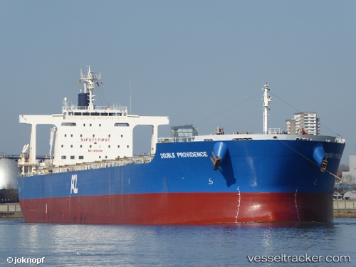
 ATLANTIC HAWK
Current Status
Where is the vessel?
ATLANTIC HAWK is currently in Near Amsterdam, based on AIS data received about 116d ago.
Latest AIS update:
Current position: 52.39769° N, 4.88135° E (Near Amsterdam)
Average speed (last 7 days): Loading…
Average speed (last 30 days): Loading…
Vessel profile: ATLANTIC HAWK is a Bulk Carrier with dimensions 235m x 235m.
This page combines live AIS, route history, probable destination signals, nearby traffic, and port activity for practical vessel monitoring.
The current position of vessel ATLANTIC HAWK is 52.39769 lat / 4.88135 lng. Updated: 2025-12-23 22:52:18 UTCNearest reference points:
- Near Amsterdam
- Near ZAANDAM
- Near SCHELLINGWOUDE
Currently sailing under the flag of Bahamas ![]()
ATLANTIC HAWK built in 2012 year
Deadweight:
95720 tDetails:
Live Vessel ATLANTIC HAWK Analytics (details, animations, etc.)
Recent AIS points (UTC):
2025-12-23 22:52:18 UTC · 52.39769, 4.88135 · SOG 0 kn · COG -1°