 vesseltracker.com
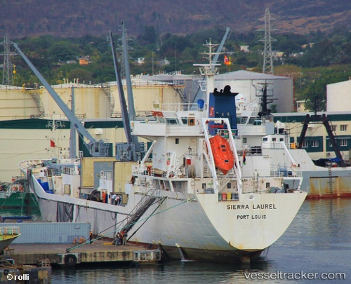
 SIERRA LAUREL
Current Status
Where is the vessel?
SIERRA LAUREL is currently in 36 nm N of Craven Arms, based on AIS data received about 1h ago.
Latest AIS update:
Current position: 53.01688° N, 2.66334° E (36 nm N of Craven Arms)
Average speed (last 7 days): Loading…
Average speed (last 30 days): Loading…
Vessel profile: SIERRA LAUREL is a Reefer with dimensions m x m.
This page combines live AIS, route history, probable destination signals, nearby traffic, and port activity for practical vessel monitoring.
The current position of vessel SIERRA LAUREL is 53.01688 lat / 2.66334 lng. Updated: 2026-04-23 05:43:57 UTCNearest reference points:
- 24 nm NE of Caister on Sea
- Near Craven Arms
- 11 nm NE of Caister on Sea
Currently sailing under the flag of Bahamas ![]()
Details:
Live Vessel SIERRA LAUREL Analytics (details, animations, etc.)
Recent AIS points (UTC):
2026-04-23 01:27:57 UTC · 52.20333, 3.34823 · SOG 15.9 kn · COG 303°2026-04-23 03:29:06 UTC · 52.41927, 2.64723 · SOG 15.1 kn · COG 2°
2026-04-23 04:39:47 UTC · 52.72622, 2.66064 · SOG 16 kn · COG 1°
2026-04-23 05:43:57 UTC · 53.01688, 2.66334 · SOG 16.6 kn · COG 1°