 vesseltracker.com
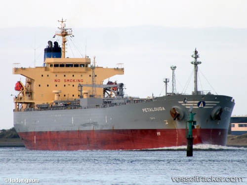
 Petalouda
Current Status
Where is the vessel?
Petalouda is currently in 27 nm NE of Mirfa, based on AIS data received about 2h ago.
Latest AIS update:
Current position: 25.68497° N, 53.91708° E (27 nm NE of Mirfa)
Average speed (last 7 days): Loading…
Average speed (last 30 days): Loading…
Vessel profile: Petalouda is a Oil Products Tanker with dimensions 182m x 182m.
This page combines live AIS, route history, probable destination signals, nearby traffic, and port activity for practical vessel monitoring.
The current position of vessel Petalouda is 25.68497 lat / 53.91708 lng. Updated: 2026-04-08 11:25:16 UTCNearest reference points:
- 11 nm SW of Fateh Terminal
- 16 nm NW of Jebel Ali
- 12 nm NW of Jebel Ali
Currently sailing under the flag of Bahamas ![]()
Petalouda built in 2008 year
Deadweight:
47322 tDetails:
Live Vessel Petalouda Analytics (details, animations, etc.)
Recent AIS points (UTC):
2026-04-08 07:49:09 UTC · 25.68485, 53.91725 · SOG 0.2 kn · COG 306°2026-04-08 09:50:44 UTC · 25.68497, 53.91708 · SOG 0.2 kn · COG -1°
2026-04-08 11:25:16 UTC · 25.68497, 53.91708 · SOG 0.2 kn · COG -1°
2026-04-08 11:25:16 UTC · 25.68497, 53.91708 · SOG 0.2 kn · COG -1°