 vesseltracker.com
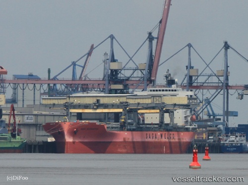
 SAGA NAVIGATOR
Current Status
Where is the vessel?
SAGA NAVIGATOR is currently in 51 nm S of Malokurilskoe, based on AIS data received about 1h ago.
Latest AIS update:
Current position: 43.04479° N, 146.59496° E (51 nm S of Malokurilskoe)
Average speed (last 7 days): Loading…
Average speed (last 30 days): Loading…
Vessel profile: SAGA NAVIGATOR is a General Cargo with dimensions m x m.
This page combines live AIS, route history, probable destination signals, nearby traffic, and port activity for practical vessel monitoring.
The current position of vessel SAGA NAVIGATOR is 43.04479 lat / 146.59496 lng. Updated: 2026-04-14 18:55:30 UTCNearest reference points:
- 27 nm SE of Tomari
- 11 nm NE of Tomari
- Near Yuzhno-Kuril'sk
Currently sailing under the flag of Bahamas ![]()
Details:
Live Vessel SAGA NAVIGATOR Analytics (details, animations, etc.)
Recent AIS points (UTC):
2026-04-14 13:38:18 UTC · 42.66049, 145.51807 · SOG 10.2 kn · COG 64°2026-04-14 14:15:12 UTC · 42.70337, 145.64874 · SOG 10.1 kn · COG 64°
2026-04-14 16:13:10 UTC · 42.81576, 146.06551 · SOG 10.1 kn · COG 59°
2026-04-14 18:55:30 UTC · 43.04479, 146.59496 · SOG 10.2 kn · COG 59°