 vesseltracker.com
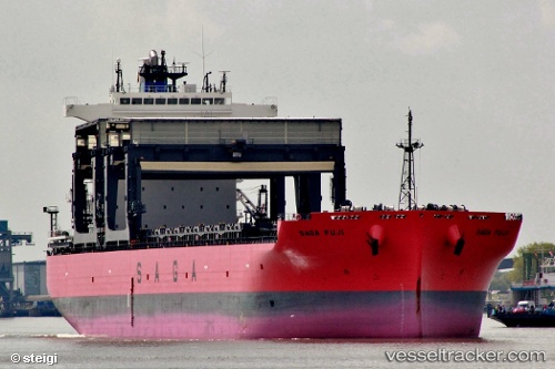
 SAGA FUJI
Current Status
Where is the vessel?
SAGA FUJI is currently in Near Santos, based on AIS data received about 1h ago.
Latest AIS update:
Current position: 23.96948° S, 46.29707° W (Near Santos)
Average speed (last 7 days): Loading…
Average speed (last 30 days): Loading…
Vessel profile: SAGA FUJI is a General Cargo with dimensions m x m.
This page combines live AIS, route history, probable destination signals, nearby traffic, and port activity for practical vessel monitoring.
The current position of vessel SAGA FUJI is -23.96948 lat / -46.29707 lng. Updated: 2026-04-14 10:26:57 UTCNearest reference points:
- Near Guarujá
- Near Santos
- 30 nm SE of Guarujá
Currently sailing under the flag of Bahamas ![]()
Details:
Live Vessel SAGA FUJI Analytics (details, animations, etc.)
Recent AIS points (UTC):
2026-04-14 04:10:33 UTC · -23.96951, -46.29701 · SOG 0 kn · COG 143°2026-04-14 06:20:58 UTC · -23.96946, -46.29706 · SOG 0 kn · COG 143°
2026-04-14 07:28:33 UTC · -23.96945, -46.29702 · SOG 0 kn · COG 143°
2026-04-14 10:26:57 UTC · -23.96948, -46.29707 · SOG 0 kn · COG 143°