 vesseltracker.com
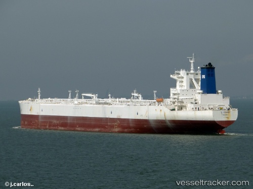
 SA OCEANIA
Current Status
Where is the vessel?
SA OCEANIA is currently in Near TANJUNG PELEPAS, based on AIS data received less than 1h ago.
Latest AIS update:
Current position: 1.28913° N, 103.39812° E (Near TANJUNG PELEPAS)
Average speed (last 7 days): Loading…
Average speed (last 30 days): Loading…
Vessel profile: SA OCEANIA is a Crude Oil Tanker with dimensions m x m.
This page combines live AIS, route history, probable destination signals, nearby traffic, and port activity for practical vessel monitoring.
The current position of vessel SA OCEANIA is 1.28913 lat / 103.39812 lng. Updated: 2026-04-23 03:24:31 UTCNearest reference points:
- 15 nm W of Tanjong Bin
- Near Tanjong Bin
- Near Tanjungbalai
Currently sailing under the flag of Bahamas ![]()
Details:
Live Vessel SA OCEANIA Analytics (details, animations, etc.)
Recent AIS points (UTC):
2026-04-22 21:21:30 UTC · 1.28868, 103.39778 · SOG 0.1 kn · COG 115°2026-04-22 22:12:29 UTC · 1.28862, 103.39772 · SOG 0.2 kn · COG 112°
2026-04-22 23:57:30 UTC · 1.28885, 103.39765 · SOG 0 kn · COG 114°
2026-04-23 03:24:31 UTC · 1.28913, 103.39812 · SOG 0 kn · COG 124°