 vesseltracker.com
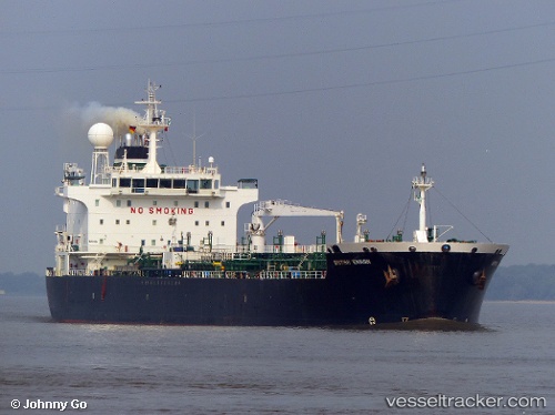
 Coast Buster
Current Status
Where is the vessel?
Coast Buster is currently in 23 nm NE of SILE, based on AIS data received about 2d ago.
Latest AIS update:
Current position: 41.51267° N, 29.84133° E (23 nm NE of SILE)
Average speed (last 7 days): Loading…
Average speed (last 30 days): Loading…
Vessel profile: Coast Buster is a Chemical/Oil Products Tanker with dimensions 184m x 28m.
This page combines live AIS, route history, probable destination signals, nearby traffic, and port activity for practical vessel monitoring.
The current position of vessel Coast Buster is 41.51267 lat / 29.84133 lng. Updated: 2026-04-09 22:40:23 UTCNearest reference points:
- 19 nm NE of RUMELI FENERI
- 45 nm N of RUMELI FENERI
- Near RUMELI FENERI
Currently sailing under the flag of Bahamas ![]()
Coast Buster built in 2006 year
Deadweight:
36713 tDetails:
Live Vessel Coast Buster Analytics (details, animations, etc.)
Recent AIS points (UTC):
2026-04-09 22:03:47 UTC · 41.47377, 29.65043 · SOG 14.4 kn · COG 74°2026-04-09 22:40:23 UTC · 41.51267, 29.84133 · SOG 14.7 kn · COG 70°
2026-04-09 22:40:23 UTC · 41.51267, 29.84133 · SOG 14.7 kn · COG 70°
2026-04-09 22:40:23 UTC · 41.51267, 29.84133 · SOG 14.7 kn · COG 70°