 vesseltracker.com
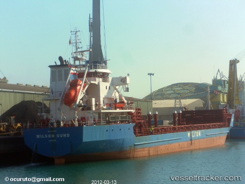
 WILSON SUND
Current Status
Where is the vessel?
WILSON SUND is currently in 81 nm NW of Alve, based on AIS data received about 2h ago.
Latest AIS update:
Current position: 66.86253° N, 4.98227° E (81 nm NW of Alve)
Average speed (last 7 days): Loading…
Average speed (last 30 days): Loading…
Vessel profile: WILSON SUND is a General Cargo with dimensions m x m.
This page combines live AIS, route history, probable destination signals, nearby traffic, and port activity for practical vessel monitoring.
The current position of vessel WILSON SUND is 66.86253 lat / 4.98227 lng. Updated: 2026-04-14 04:52:49 UTCCurrently sailing under the flag of Bahamas ![]()
Details:
Live Vessel WILSON SUND Analytics (details, animations, etc.)
Recent AIS points (UTC):
2026-04-13 23:42:41 UTC · 66.69667, 3.00650 · SOG 9.3 kn · COG 76°2026-04-14 01:55:58 UTC · 66.77933, 3.82883 · SOG 9.8 kn · COG 80°
2026-04-14 03:16:49 UTC · 66.82354, 4.37223 · SOG 9.6 kn · COG 82°
2026-04-14 04:52:49 UTC · 66.86253, 4.98227 · SOG 9.1 kn · COG 83°