 vesseltracker.com
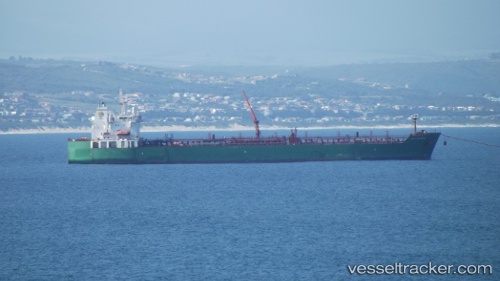
 Gulf Baynunah
Current Status
Where is the vessel?
Gulf Baynunah is currently in 57 nm W of Mathilakam, based on AIS data received about 1h ago.
Latest AIS update:
Current position: 10.20278° N, 75.20968° E (57 nm W of Mathilakam)
Average speed (last 7 days): Loading…
Average speed (last 30 days): Loading…
Vessel profile: Gulf Baynunah is a Chemical Oil Products Tanker with dimensions 183m x 32m.
This page combines live AIS, route history, probable destination signals, nearby traffic, and port activity for practical vessel monitoring.
The current position of vessel Gulf Baynunah is 10.20278 lat / 75.20968 lng. Updated: 2026-04-18 05:42:17 UTCNearest reference points:
- Near Cochin
- Near Edappally
- 45 nm SW of Kalpeni Island
Currently sailing under the flag of Bahamas ![]()
Gulf Baynunah built in 2008 year
Deadweight:
46522 tDetails:
Live Vessel Gulf Baynunah Analytics (details, animations, etc.)
Recent AIS points (UTC):
2026-04-17 21:48:59 UTC · 8.99430, 75.87315 · SOG 9.8 kn · COG 338°2026-04-18 00:17:34 UTC · 9.33820, 75.67615 · SOG 9.7 kn · COG 331°
2026-04-18 04:17:23 UTC · 9.94122, 75.35123 · SOG 9.7 kn · COG 330°
2026-04-18 05:42:17 UTC · 10.20278, 75.20968 · SOG 14.8 kn · COG 334°