 vesseltracker.com
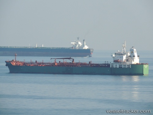
 Gulf Jumeirah
Current Status
Where is the vessel?
Gulf Jumeirah is currently in 313 nm S of Vostok, based on AIS data received about 78d ago.
Latest AIS update:
Current position: 83.58693° S, 100.21208° E (313 nm S of Vostok)
Average speed (last 7 days): Loading…
Average speed (last 30 days): Loading…
Vessel profile: Gulf Jumeirah is a Chemical Oil Products Tanker with dimensions 183m x 183m.
This page combines live AIS, route history, probable destination signals, nearby traffic, and port activity for practical vessel monitoring.
The current position of vessel Gulf Jumeirah is -83.58693 lat / 100.21208 lng. Updated: 2026-01-23 18:29:12 UTCCurrently sailing under the flag of Bahamas ![]()
Gulf Jumeirah built in 2008 year
Deadweight:
46488 tDetails:
Live Vessel Gulf Jumeirah Analytics (details, animations, etc.)
Recent AIS points (UTC):
2026-01-23 18:29:12 UTC · -83.58693, 100.21208 · SOG 22.4 kn · COG 75°