 vesseltracker.com
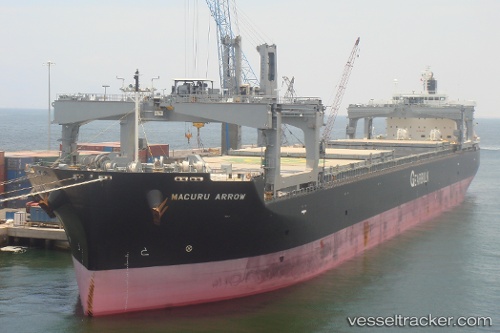
Macuru Arrow
Current StatusWhere is the vessel?
Macuru Arrow is currently in 16 nm E of ITAPOA, based on AIS data received less than 1h ago.
Latest AIS update:
Current position: 26.23395° S, 48.31082° W (16 nm E of ITAPOA)
Average speed (last 7 days): Loading…
Average speed (last 30 days): Loading…
Vessel profile: Macuru Arrow is a Bulk Carrier with dimensions 32m x 225m.
This page combines live AIS, route history, probable destination signals, nearby traffic, and port activity for practical vessel monitoring.
The current position of vessel Macuru Arrow is -26.23395 lat / -48.31082 lng. Updated: 2026-04-09 22:22:43 UTCNearest reference points:
- 32 nm E of Caioba
- 24 nm E of Caioba
- 10 nm NE of CAMBORIU
Details:
Live Vessel Macuru Arrow Analytics (details, animations, etc.)
Recent AIS points (UTC):
2026-04-09 16:07:46 UTC · -25.50071, -48.50069 · SOG 0 kn · COG 261°2026-04-09 18:11:32 UTC · -25.62028, -48.25558 · SOG 7.5 kn · COG 107°
2026-04-09 20:13:21 UTC · -25.99000, -48.24667 · SOG 12 kn · COG -1°
2026-04-09 22:22:43 UTC · -26.23395, -48.31082 · SOG 0.9 kn · COG 54°