 vesseltracker.com
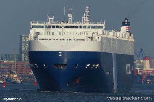
 Harmony Leader
Current Status
Where is the vessel?
Harmony Leader is currently in Open sea, approx. 509 nm off the nearest listed port, based on AIS data received less than 1h ago.
Latest AIS update:
Current position: 33.39655° N, 161.09959° W (Open sea, approx. 509 nm off the nearest listed port)
Average speed (last 7 days): Loading…
Average speed (last 30 days): Loading…
Vessel profile: Harmony Leader is a Vehicles Carrier with dimensions 200m x 32m.
This page combines live AIS, route history, probable destination signals, nearby traffic, and port activity for practical vessel monitoring.
The current position of vessel Harmony Leader is 33.39655 lat / -161.09959 lng. Updated: 2026-04-01 17:22:05 UTCNearest reference points:
- Open sea, approx. 509 nm off the nearest listed port
- Open sea, approx. 503 nm off the nearest listed port
- Open sea, approx. 524 nm off the nearest listed port
Currently sailing under the flag of Bahamas ![]()
Harmony Leader built in 2011 year
Deadweight:
20434 tDetails:
Live Vessel Harmony Leader Analytics (details, animations, etc.)
Recent AIS points (UTC):
2026-04-01 10:00:13 UTC · 33.16992, -158.81302 · SOG 15.6 kn · COG 278°2026-04-01 12:05:31 UTC · 33.24168, -159.46159 · SOG 15.7 kn · COG 277°
2026-04-01 15:20:28 UTC · 33.33118, -160.47427 · SOG 15.5 kn · COG 280°
2026-04-01 17:22:05 UTC · 33.39655, -161.09959 · SOG 15.6 kn · COG 275°