 vesseltracker.com
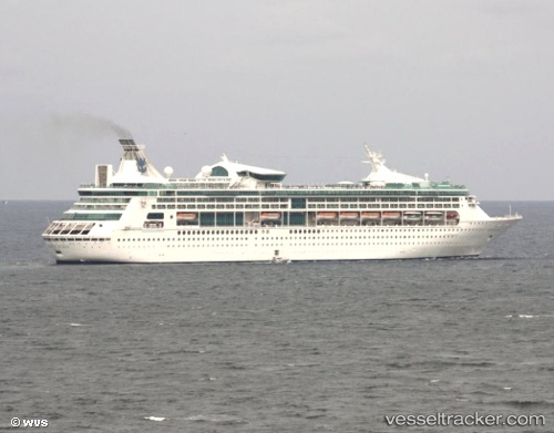
 Grandeur Of The Seas
Current Status
Where is the vessel?
Grandeur Of The Seas is currently in 20 nm S of Mahahual, based on AIS data received less than 1h ago.
Latest AIS update:
Current position: 18.37833° N, 87.63833° W (20 nm S of Mahahual)
Average speed (last 7 days): Loading…
Average speed (last 30 days): Loading…
Vessel profile: Grandeur Of The Seas is a Cruise Ship with dimensions 280m x 37m.
This page combines live AIS, route history, probable destination signals, nearby traffic, and port activity for practical vessel monitoring.
The current position of vessel Grandeur Of The Seas is 18.37833 lat / -87.63833 lng. Updated: 2026-04-02 08:23:19 UTCNearest reference points:
- 14 nm SE of Belize
- 26 nm SE of Dangriga
- 12 nm SW of Dangriga
Currently sailing under the flag of Bahamas ![]()
Grandeur Of The Seas built in 1996 year
Deadweight:
7000 tDetails:
Live Vessel Grandeur Of The Seas Analytics (details, animations, etc.)
Recent AIS points (UTC):
2026-04-02 01:26:18 UTC · 17.50500, -87.93667 · SOG 12 kn · COG -1°2026-04-02 03:20:19 UTC · 17.79833, -87.81500 · SOG 7 kn · COG -1°
2026-04-02 06:02:20 UTC · 18.10167, -87.69167 · SOG 8 kn · COG -1°
2026-04-02 08:23:19 UTC · 18.37833, -87.63833 · SOG 7 kn · COG -1°