 vesseltracker.com
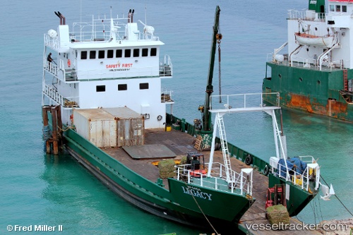
Legacy
Current StatusWhere is the vessel?
Legacy is currently in Near Great Harbour Cay, based on AIS data received about 2h ago.
Latest AIS update:
Current position: 25.75625° N, 77.87332° W (Near Great Harbour Cay)
Average speed (last 7 days): Loading…
Average speed (last 30 days): Loading…
Vessel profile: Legacy is a Passenger General Cargo Ship with dimensions 10m x 47m.
This page combines live AIS, route history, probable destination signals, nearby traffic, and port activity for practical vessel monitoring.
The current position of vessel Legacy is 25.75625 lat / -77.87332 lng. Updated: 2026-04-02 09:53:47 UTCNearest reference points:
- 27 nm SE of Gorda Cay
- Near Nassau
- Near Lyford Cay
Details:
Live Vessel Legacy Analytics (details, animations, etc.)
Recent AIS points (UTC):
2026-04-02 03:35:17 UTC · 25.48707, -77.59733 · SOG 7.8 kn · COG -1°2026-04-02 06:04:06 UTC · 25.79213, -77.78848 · SOG 8.6 kn · COG -1°
2026-04-02 08:25:06 UTC · 25.76268, -77.93945 · SOG 7.8 kn · COG -1°
2026-04-02 09:53:47 UTC · 25.75625, -77.87332 · SOG 0 kn · COG -1°