 vesseltracker.com
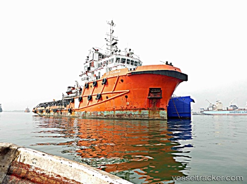
Go Acamar
Current StatusWhere is the vessel?
Go Acamar is currently in Near Diamond, based on AIS data received about 1h ago.
Latest AIS update:
Current position: 6.65338° N, 58.19261° W (Near Diamond)
Average speed (last 7 days): Loading…
Average speed (last 30 days): Loading…
Vessel profile: Go Acamar is a Offshore Tug Supply Ship with dimensions 14m x 57m.
This page combines live AIS, route history, probable destination signals, nearby traffic, and port activity for practical vessel monitoring.
The current position of vessel Go Acamar is 6.65338 lat / -58.19261 lng. Updated: 2026-04-15 22:07:17 UTCNearest reference points:
- 57 nm NE of Adventure
- 38 nm NW of Jarikaba
Details:
Live Vessel Go Acamar Analytics (details, animations, etc.)
Recent AIS points (UTC):
2026-04-15 16:03:36 UTC · 6.65322, -58.19266 · SOG 0 kn · COG 203°2026-04-15 17:48:14 UTC · 6.65336, -58.19259 · SOG 0 kn · COG 204°
2026-04-15 19:25:26 UTC · 6.65332, -58.19257 · SOG 0 kn · COG 204°
2026-04-15 22:07:17 UTC · 6.65338, -58.19261 · SOG 0 kn · COG -1°