 vesseltracker.com
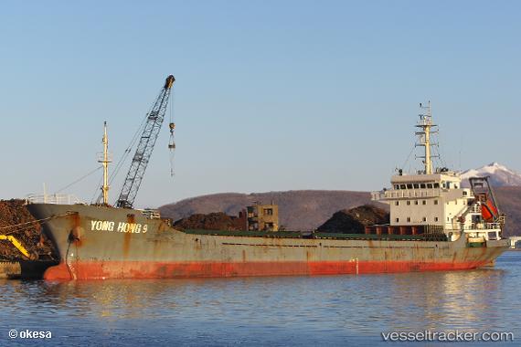
Yong Hong 9
Current StatusWhere is the vessel?
Yong Hong 9 is currently in Near Toshima/Tokyo, based on AIS data received about 1h ago.
Latest AIS update:
Current position: 34.63233° N, 139.37381° E (Near Toshima/Tokyo)
Average speed (last 7 days): Loading…
Average speed (last 30 days): Loading…
Vessel profile: Yong Hong 9 is a General Cargo Ship with dimensions 16m x 97m.
This page combines live AIS, route history, probable destination signals, nearby traffic, and port activity for practical vessel monitoring.
The current position of vessel Yong Hong 9 is 34.63233 lat / 139.37381 lng. Updated: 2026-04-22 06:12:28 UTCNearest reference points:
- Near Toshima/Tokyo
- Near Nishitokyo
- Near Iruma
Details:
Live Vessel Yong Hong 9 Analytics (details, animations, etc.)
Recent AIS points (UTC):
2026-04-22 01:27:25 UTC · 34.51333, 138.52167 · SOG 10 kn · COG -1°2026-04-22 03:44:43 UTC · 34.53667, 138.92332 · SOG 9 kn · COG -1°
2026-04-22 04:23:27 UTC · 34.55833, 139.04167 · SOG 9 kn · COG -1°
2026-04-22 06:12:28 UTC · 34.63233, 139.37381 · SOG 9.1 kn · COG 71°