 vesseltracker.com
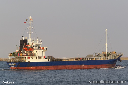
 Sea Bridge
Current Status
Where is the vessel?
Sea Bridge is currently in Near Toyama , based on AIS data received about 7h ago.
Latest AIS update:
Current position: 36.76076° N, 137.22787° E (Near Toyama )
Average speed (last 7 days): Loading…
Average speed (last 30 days): Loading…
Vessel profile: Sea Bridge is a General Cargo Ship with dimensions 76m x 76m.
This page combines live AIS, route history, probable destination signals, nearby traffic, and port activity for practical vessel monitoring.
The current position of vessel Sea Bridge is 36.76076 lat / 137.22787 lng. Updated: 2026-03-31 20:18:53 UTCNearest reference points:
- Near Toyama
- Near Nagoya
- Near Yokkaichi
Currently sailing under the flag of Belize ![]()
Sea Bridge built in 1998 year
Deadweight:
1593 tDetails:
Live Vessel Sea Bridge Analytics (details, animations, etc.)
Recent AIS points (UTC):
2026-03-31 05:13:03 UTC · 36.76833, 137.22501 · SOG 5 kn · COG -1°2026-03-31 20:18:53 UTC · 36.76076, 137.22787 · SOG 0.1 kn · COG 194°
2026-03-31 20:18:53 UTC · 36.76076, 137.22787 · SOG 0.1 kn · COG 194°
2026-03-31 20:18:53 UTC · 36.76076, 137.22787 · SOG 0.1 kn · COG 194°