 vesseltracker.com
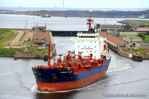
 CUMBRIAN
Current Status
Where is the vessel?
CUMBRIAN is currently in 61 nm S of Ordzhonikidze, based on AIS data received about 1d ago.
Latest AIS update:
Current position: 43.92501° N, 35.71885° E (61 nm S of Ordzhonikidze)
Average speed (last 7 days): Loading…
Average speed (last 30 days): Loading…
Vessel profile: CUMBRIAN is a Oil/Chemical Tanker with dimensions m x m.
This page combines live AIS, route history, probable destination signals, nearby traffic, and port activity for practical vessel monitoring.
The current position of vessel CUMBRIAN is 43.92501 lat / 35.71885 lng. Updated: 2026-04-17 20:45:36 UTCNearest reference points:
- 79 nm SE of Yalta
- 76 nm N of Sinop
- Near Feodosiia
Currently sailing under the flag of Barbados ![]()
Details:
Live Vessel CUMBRIAN Analytics (details, animations, etc.)
Recent AIS points (UTC):
2026-04-17 19:50:19 UTC · 43.85235, 35.53290 · SOG 9.9 kn · COG 62°2026-04-17 20:45:36 UTC · 43.92501, 35.71885 · SOG 19 kn · COG 63°
2026-04-17 20:45:36 UTC · 43.92501, 35.71885 · SOG 19 kn · COG 63°
2026-04-17 20:45:36 UTC · 43.92501, 35.71885 · SOG 19 kn · COG 63°