 vesseltracker.com
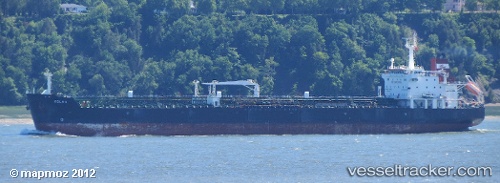
 CH ELIXIR
Current Status
Where is the vessel?
CH ELIXIR is currently in 16 nm S of Punda, based on AIS data received less than 1h ago.
Latest AIS update:
Current position: 11.84828° N, 69.01466° W (16 nm S of Punda)
Average speed (last 7 days): Loading…
Average speed (last 30 days): Loading…
Vessel profile: CH ELIXIR is a Oil/Chemical Tanker with dimensions m x m.
This page combines live AIS, route history, probable destination signals, nearby traffic, and port activity for practical vessel monitoring.
The current position of vessel CH ELIXIR is 11.84828 lat / -69.01466 lng. Updated: 2026-04-13 06:20:21 UTCNearest reference points:
- Near Bullenbaai
- Near Las Piedras
- 24 nm NW of Palm Beach
Currently sailing under the flag of Barbados ![]()
Details:
Live Vessel CH ELIXIR Analytics (details, animations, etc.)
Recent AIS points (UTC):
2026-04-12 23:29:08 UTC · 12.25645, -70.09664 · SOG 10.1 kn · COG 76°2026-04-13 02:43:31 UTC · 12.08136, -69.60995 · SOG 10.6 kn · COG 122°
2026-04-13 04:11:04 UTC · 11.98864, -69.36324 · SOG 10.5 kn · COG 116°
2026-04-13 06:20:21 UTC · 11.84828, -69.01466 · SOG 10.4 kn · COG 115°