 vesseltracker.com
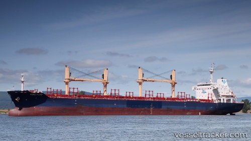
 LADY LITEL
Current Status
Where is the vessel?
LADY LITEL is currently in 319 nm SW of Malaga, based on AIS data received about 1h ago.
Latest AIS update:
Current position: 1.06381° S, 6.76146° W (319 nm SW of Malaga)
Average speed (last 7 days): Loading…
Average speed (last 30 days): Loading…
Vessel profile: LADY LITEL is a Bulk Carrier with dimensions m x m.
This page combines live AIS, route history, probable destination signals, nearby traffic, and port activity for practical vessel monitoring.
The current position of vessel LADY LITEL is -1.06381 lat / -6.76146 lng. Updated: 2026-04-13 02:29:16 UTCNearest reference points:
- Open sea, approx. 401 nm off the nearest listed port
- Open sea, approx. 402 nm off the nearest listed port
- Open sea, approx. 403 nm off the nearest listed port
Currently sailing under the flag of Barbados ![]()
Details:
Live Vessel LADY LITEL Analytics (details, animations, etc.)
Recent AIS points (UTC):
2026-04-12 19:53:36 UTC · -0.17090, -5.70704 · SOG 12.8 kn · COG 227°2026-04-12 21:32:13 UTC · -0.38922, -5.96425 · SOG 12 kn · COG 228°
2026-04-12 23:22:44 UTC · -0.63834, -6.25824 · SOG 12.8 kn · COG 228°
2026-04-13 02:29:16 UTC · -1.06381, -6.76146 · SOG 12.7 kn · COG 230°