 vesseltracker.com
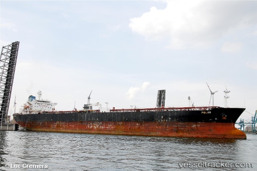
 NORTH STAR
Current Status
Where is the vessel?
NORTH STAR is currently in 34 nm N of Offshore Fujairah, based on AIS data received about 3h ago.
Latest AIS update:
Current position: 25.77111° N, 56.89811° E (34 nm N of Offshore Fujairah)
Average speed (last 7 days): Loading…
Average speed (last 30 days): Loading…
Vessel profile: NORTH STAR is a Crude Oil Tanker with dimensions m x m.
This page combines live AIS, route history, probable destination signals, nearby traffic, and port activity for practical vessel monitoring.
The current position of vessel NORTH STAR is 25.77111 lat / 56.89811 lng. Updated: 2026-04-01 00:44:33 UTCNearest reference points:
- 30 nm NE of Offshore Fujairah
- 34 nm NE of Offshore Fujairah
- 29 nm NE of Offshore Fujairah
Currently sailing under the flag of Barbados ![]()
Details:
Live Vessel NORTH STAR Analytics (details, animations, etc.)
Recent AIS points (UTC):
2026-03-31 21:11:45 UTC · 25.77143, 56.89882 · SOG 0.2 kn · COG -1°2026-04-01 00:09:58 UTC · 25.77098, 56.89871 · SOG 0.4 kn · COG -1°
2026-04-01 00:44:33 UTC · 25.77111, 56.89811 · SOG 0 kn · COG -1°
2026-04-01 00:44:33 UTC · 25.77111, 56.89811 · SOG 0 kn · COG -1°