 vesseltracker.com
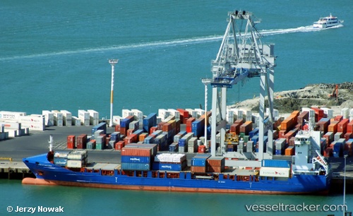
 RMS MEL
Current Status
Where is the vessel?
RMS MEL is currently in 137 nm S of Kastellorizou (ex Megísti), based on AIS data received about 2h ago.
Latest AIS update:
Current position: 33.86964° N, 29.58939° E (137 nm S of Kastellorizou (ex Megísti))
Average speed (last 7 days): Loading…
Average speed (last 30 days): Loading…
Vessel profile: RMS MEL is a Container Ship with dimensions m x m.
This page combines live AIS, route history, probable destination signals, nearby traffic, and port activity for practical vessel monitoring.
The current position of vessel RMS MEL is 33.86964 lat / 29.58939 lng. Updated: 2026-04-20 12:17:44 UTCNearest reference points:
- 108 nm S of Kastellorizou (ex Megísti)
- 129 nm NW of ABU QIR
- 91 nm SE of Polychnitos Lesvou
Currently sailing under the flag of Barbados ![]()
Details:
Live Vessel RMS MEL Analytics (details, animations, etc.)
Recent AIS points (UTC):
2026-04-20 10:17:34 UTC · 33.51947, 29.94993 · SOG 13.1 kn · COG -1°2026-04-20 12:02:43 UTC · 33.82574, 29.63557 · SOG 14.1 kn · COG -1°
2026-04-20 12:17:44 UTC · 33.86964, 29.58939 · SOG 13.8 kn · COG -1°
2026-04-20 12:17:44 UTC · 33.86964, 29.58939 · SOG 13.8 kn · COG -1°