 vesseltracker.com
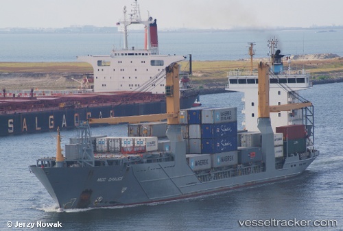
 MERIOS
Current Status
Where is the vessel?
MERIOS is currently in 10 nm S of Marmara Ereglisi, based on AIS data received less than 1h ago.
Latest AIS update:
Current position: 40.79990° N, 27.92172° E (10 nm S of Marmara Ereglisi)
Average speed (last 7 days): Loading…
Average speed (last 30 days): Loading…
Vessel profile: MERIOS is a Container Ship with dimensions m x m.
This page combines live AIS, route history, probable destination signals, nearby traffic, and port activity for practical vessel monitoring.
The current position of vessel MERIOS is 40.79990 lat / 27.92172 lng. Updated: 2026-04-22 01:20:02 UTCNearest reference points:
- Near Saraylar
- 11 nm E of Erdek
- Near TEKIRDAG
Currently sailing under the flag of Barbados ![]()
Details:
Live Vessel MERIOS Analytics (details, animations, etc.)
Recent AIS points (UTC):
2026-04-21 21:36:04 UTC · 40.81851, 28.12937 · SOG 13.3 kn · COG 259°2026-04-21 22:53:10 UTC · 40.77873, 27.74838 · SOG 13.5 kn · COG 260°
2026-04-22 00:04:19 UTC · 40.69086, 27.42718 · SOG 13.3 kn · COG 233°
2026-04-22 01:20:02 UTC · 40.79990, 27.92172 · SOG 13.5 kn · COG 260°