 vesseltracker.com
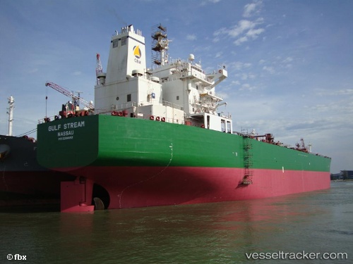
 MULE
MULE
Current Status
Where is the vessel?
MULE is currently in Near Al Qantarah El Sharqiyya, based on AIS data received less than 1h ago.
Latest AIS update:
Current position: 30.79137° N, 32.31547° E (Near Al Qantarah El Sharqiyya)
Average speed (last 7 days): Loading…
Average speed (last 30 days): Loading…
Vessel profile: MULE is a Oil Products Tanker with dimensions 227m x 32m.
This page combines live AIS, route history, probable destination signals, nearby traffic, and port activity for practical vessel monitoring.
The current position of vessel MULE is 30.79137 lat / 32.31547 lng. Updated: 2026-04-10 07:34:38 UTCNearest reference points:
- Near Port Said East
- Near Port Said
- Near SUEZ CANAL
Currently sailing under the flag of Barbados ![]()
MULE built in 2005 year
Deadweight:
74999 tDetails:
Live Vessel MULE Analytics (details, animations, etc.)
Recent AIS points (UTC):
2026-04-10 02:16:55 UTC · 31.41606, 32.31829 · SOG 8.3 kn · COG 106°2026-04-10 04:02:17 UTC · 31.27933, 32.35998 · SOG 6.4 kn · COG 194°
2026-04-10 05:31:26 UTC · 31.09242, 32.30810 · SOG 8.9 kn · COG 177°
2026-04-10 07:34:38 UTC · 30.79137, 32.31547 · SOG 9 kn · COG 179°