 vesseltracker.com
 ROUTE
ROUTE
Current Status
Where is the vessel?
ROUTE is currently in 16 nm E of Il-Kappara, based on AIS data received about 2h ago.
Latest AIS update:
Current position: 35.87298° N, 14.88495° E (16 nm E of Il-Kappara)
Average speed (last 7 days): Loading…
Average speed (last 30 days): Loading…
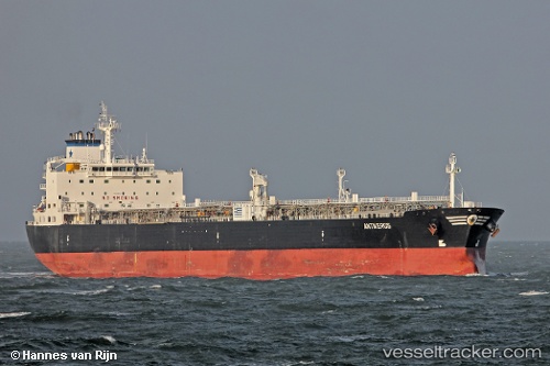
Vessel profile: ROUTE is a Crude Oil Tanker with dimensions 228m x 32m.
This page combines live AIS, route history, probable destination signals, nearby traffic, and port activity for practical vessel monitoring.
The current position of vessel ROUTE is 35.87298 lat / 14.88495 lng. Updated: 2026-03-29 01:22:00 UTCNearest reference points:
- 13 nm E of Il-Kappara
- 18 nm E of Il-Kappara
- Near Xghajra
Currently sailing under the flag of Barbados ![]()
ROUTE built in 2004 year
Deadweight:
69714 tDetails:
Live Vessel ROUTE Analytics (details, animations, etc.)
Recent AIS points (UTC):
2026-03-28 19:35:11 UTC · 35.83413, 15.24778 · SOG 11.7 kn · COG 283°2026-03-28 21:36:29 UTC · 35.87495, 14.88406 · SOG 0.4 kn · COG 313°
2026-03-29 00:16:00 UTC · 35.87330, 14.88535 · SOG 1 kn · COG 302°
2026-03-29 01:22:00 UTC · 35.87298, 14.88495 · SOG 0.7 kn · COG 318°