 vesseltracker.com
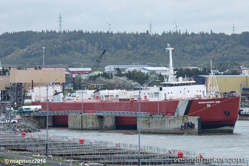
Georges A Lebel
Current StatusWhere is the vessel?
Georges A Lebel is currently in 20 nm NE of Metis-sur-Mer, based on AIS data received about 1h ago.
Latest AIS update:
Current position: 48.84360° N, 67.57363° W (20 nm NE of Metis-sur-Mer)
Average speed (last 7 days): Loading…
Average speed (last 30 days): Loading…
Vessel profile: Georges A Lebel is a Ro Ro Cargo Ship with dimensions 20m x 130m.
This page combines live AIS, route history, probable destination signals, nearby traffic, and port activity for practical vessel monitoring.
The current position of vessel Georges A Lebel is 48.84360 lat / -67.57363 lng. Updated: 2026-04-19 10:38:08 UTCNearest reference points:
- 15 nm NW of Saint-Anaclet
- 22 nm N of Sainte-Anne-des-Monts
Details:
Live Vessel Georges A Lebel Analytics (details, animations, etc.)
Recent AIS points (UTC):
2026-04-19 05:28:55 UTC · 48.84359, -67.57359 · SOG 0 kn · COG -1°2026-04-19 08:27:56 UTC · 48.84360, -67.57359 · SOG 0 kn · COG -1°
2026-04-19 09:13:00 UTC · 48.84359, -67.57362 · SOG 0 kn · COG -1°
2026-04-19 10:38:08 UTC · 48.84360, -67.57363 · SOG 0 kn · COG -1°