 vesseltracker.com
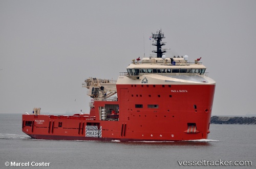
Paul A. Sacuta
Current StatusWhere is the vessel?
Paul A. Sacuta is currently in Near St. John’S, based on AIS data received less than 1h ago.
Latest AIS update:
Current position: 47.56858° N, 52.70010° W (Near St. John’S)
Average speed (last 7 days): Loading…
Average speed (last 30 days): Loading…
Vessel profile: Paul A. Sacuta is a Offshore Tug Supply Ship with dimensions 22m x 91m.
This page combines live AIS, route history, probable destination signals, nearby traffic, and port activity for practical vessel monitoring.
The current position of vessel Paul A. Sacuta is 47.56858 lat / -52.70010 lng. Updated: 2026-04-17 09:39:42 UTCNearest reference points:
- Near St. John’S
- Near Witless Bay
- Near Catalina
Details:
Live Vessel Paul A. Sacuta Analytics (details, animations, etc.)
Recent AIS points (UTC):
2026-04-17 03:24:36 UTC · 47.56858, -52.70008 · SOG 0 kn · COG 234°2026-04-17 05:48:37 UTC · 47.56858, -52.70009 · SOG 0 kn · COG 234°
2026-04-17 08:15:36 UTC · 47.56858, -52.70009 · SOG 0 kn · COG 234°
2026-04-17 09:39:42 UTC · 47.56858, -52.70010 · SOG 0 kn · COG 234°