 vesseltracker.com
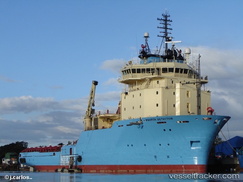
 Maersk Detector
Current Status
Where is the vessel?
Maersk Detector is currently in Near North Saanich, based on AIS data received about 497d ago.
Latest AIS update:
Current position: 48.65205° N, 123.44972° W (Near North Saanich)
Average speed (last 7 days): Loading…
Average speed (last 30 days): Loading…
Vessel profile: Maersk Detector is a Offshore Tug Supply Ship with dimensions 90m x 20m.
This page combines live AIS, route history, probable destination signals, nearby traffic, and port activity for practical vessel monitoring.
The current position of vessel Maersk Detector is 48.65205 lat / -123.44972 lng. Updated: 2024-11-19 13:58:09 UTCNearest reference points:
- Near North Saanich
- Near Salt Spring Island
- Near GANGES
Currently sailing under the flag of Canada ![]()
Maersk Detector built in 2006 year
Deadweight:
4027 tDetails:
Live Vessel Maersk Detector Analytics (details, animations, etc.)
Recent AIS points (UTC):
2024-11-19 13:58:09 UTC · 48.65205, -123.44972 · SOG 4.8 kn · COG 72°