 vesseltracker.com
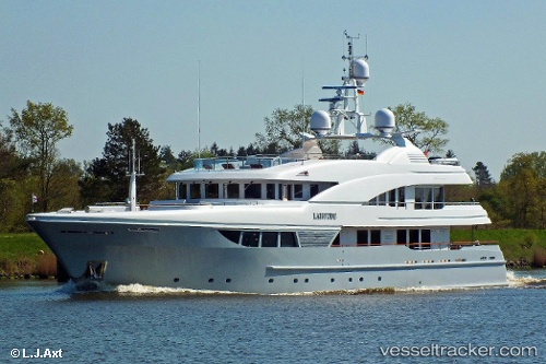
 LADY B
Current Status
Where is the vessel?
LADY B is currently in Near Panama Canal, based on AIS data received about 2h ago.
Latest AIS update:
Current position: 9.03639° N, 79.64153° W (Near Panama Canal)
Average speed (last 7 days): Loading…
Average speed (last 30 days): Loading…
Vessel profile: LADY B is a Yacht with dimensions m x m.
This page combines live AIS, route history, probable destination signals, nearby traffic, and port activity for practical vessel monitoring.
The current position of vessel LADY B is 9.03639 lat / -79.64153 lng. Updated: 2026-04-23 04:08:26 UTCNearest reference points:
- Near Panama Canal
- Near Cocoli
- Near El Chorrillo
Currently sailing under the flag of Cayman Islands ![]()
Details:
Live Vessel LADY B Analytics (details, animations, etc.)
Recent AIS points (UTC):
2026-04-22 22:16:31 UTC · 8.90800, -79.50964 · SOG 0.2 kn · COG 311°2026-04-22 23:41:47 UTC · 8.90857, -79.50957 · SOG 0.7 kn · COG 286°
2026-04-23 03:43:48 UTC · 9.01646, -79.61177 · SOG 0 kn · COG 310°
2026-04-23 04:08:26 UTC · 9.03639, -79.64153 · SOG 11.1 kn · COG 311°