 vesseltracker.com
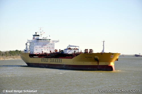
Stolt Sneland
Current StatusWhere is the vessel?
Stolt Sneland is currently in Near BUKOM ISLAND, based on AIS data received less than 1h ago.
Latest AIS update:
Current position: 1.16672° N, 103.71263° E (Near BUKOM ISLAND)
Average speed (last 7 days): Loading…
Average speed (last 30 days): Loading…
Vessel profile: Stolt Sneland is a Chemical Oil Products Tanker with dimensions 32m x 182m.
This page combines live AIS, route history, probable destination signals, nearby traffic, and port activity for practical vessel monitoring.
The current position of vessel Stolt Sneland is 1.16672 lat / 103.71263 lng. Updated: 2026-04-21 07:20:23 UTCNearest reference points:
- Near BUKOM ISLAND
- Near JURONG ISLAND
- Near Pulau Ayer Chawan
Details:
Live Vessel Stolt Sneland Analytics (details, animations, etc.)
Recent AIS points (UTC):
2026-04-21 03:36:06 UTC · 1.16704, 103.71436 · SOG 0 kn · COG 308°2026-04-21 04:20:21 UTC · 1.16673, 103.71402 · SOG 0 kn · COG 320°
2026-04-21 05:35:46 UTC · 1.16807, 103.71466 · SOG 0.1 kn · COG 261°
2026-04-21 07:20:23 UTC · 1.16672, 103.71263 · SOG 0 kn · COG 28°