 vesseltracker.com
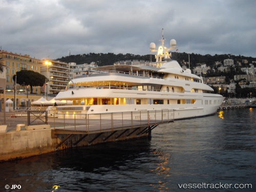
 MONTKAJ
Current Status
Where is the vessel?
MONTKAJ is currently in Near LA CIOTAT, based on AIS data received less than 1h ago.
Latest AIS update:
Current position: 43.17196° N, 5.61248° E (Near LA CIOTAT)
Average speed (last 7 days): Loading…
Average speed (last 30 days): Loading…
Vessel profile: MONTKAJ is a Yacht with dimensions m x m.
This page combines live AIS, route history, probable destination signals, nearby traffic, and port activity for practical vessel monitoring.
The current position of vessel MONTKAJ is 43.17196 lat / 5.61248 lng. Updated: 2026-04-21 17:58:41 UTCNearest reference points:
- Near LA CIOTAT
- Near Six-Fours-les-Plages
- Near Le Canet
Currently sailing under the flag of Cayman Islands ![]()
Details:
Live Vessel MONTKAJ Analytics (details, animations, etc.)
Recent AIS points (UTC):
2026-04-21 13:44:11 UTC · 43.17195, 5.61247 · SOG 0 kn · COG -1°2026-04-21 15:34:42 UTC · 43.17195, 5.61246 · SOG 0 kn · COG -1°
2026-04-21 16:18:42 UTC · 43.17197, 5.61247 · SOG 0 kn · COG -1°
2026-04-21 17:58:41 UTC · 43.17196, 5.61248 · SOG 0 kn · COG -1°