 vesseltracker.com
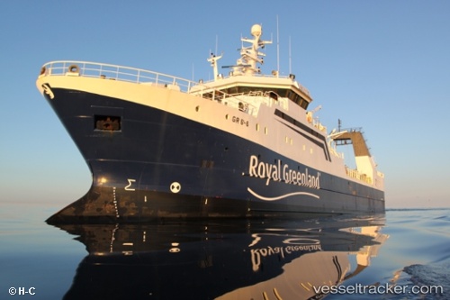
 Akamalik
Current Status
Where is the vessel?
Akamalik is currently in 66 nm W of Illorsuit, based on AIS data received about 2h ago.
Latest AIS update:
Current position: 70.56099° N, 56.07008° W (66 nm W of Illorsuit)
Average speed (last 7 days): Loading…
Average speed (last 30 days): Loading…
Vessel profile: Akamalik is a Fishing Vessel with dimensions 75m x 75m.
This page combines live AIS, route history, probable destination signals, nearby traffic, and port activity for practical vessel monitoring.
The current position of vessel Akamalik is 70.56099 lat / -56.07008 lng. Updated: 2026-04-10 01:26:21 UTCNearest reference points:
- Near Godhavn
Currently sailing under the flag of Greenland ![]()
Akamalik built in 2001 year
Deadweight:
1000 tDetails:
Live Vessel Akamalik Analytics (details, animations, etc.)
Recent AIS points (UTC):
2026-04-09 15:41:28 UTC · 70.55575, -56.05203 · SOG 5.7 kn · COG 59°2026-04-09 21:55:11 UTC · 70.56607, -56.02357 · SOG 2 kn · COG 74°
2026-04-09 23:45:11 UTC · 70.55838, -56.09463 · SOG 2.2 kn · COG 233°
2026-04-10 01:26:21 UTC · 70.56099, -56.07008 · SOG 2 kn · COG 66°