 vesseltracker.com
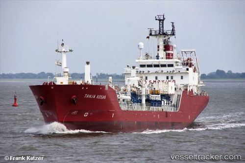
 GALAXY GAS
Current Status
Where is the vessel?
GALAXY GAS is currently in 19 nm S of Kiamari, based on AIS data received about 1d ago.
Latest AIS update:
Current position: 24.50690° N, 66.95644° E (19 nm S of Kiamari)
Average speed (last 7 days): Loading…
Average speed (last 30 days): Loading…
Vessel profile: GALAXY GAS is a Lpg Tanker with dimensions m x m.
This page combines live AIS, route history, probable destination signals, nearby traffic, and port activity for practical vessel monitoring.
The current position of vessel GALAXY GAS is 24.50690 lat / 66.95644 lng. Updated: 2026-04-10 06:58:48 UTCNearest reference points:
- 16 nm S of Kiamari
- Near Kiamari
- Near PORT QASIM
Currently sailing under the flag of Haiti ![]()
Details:
Live Vessel GALAXY GAS Analytics (details, animations, etc.)
Recent AIS points (UTC):
2026-04-10 01:48:20 UTC · 24.78214, 67.23761 · SOG 8.6 kn · COG -1°2026-04-10 03:33:30 UTC · 24.58699, 67.07221 · SOG 8.3 kn · COG -1°
2026-04-10 05:53:13 UTC · 24.50625, 66.95696 · SOG 0.5 kn · COG -1°
2026-04-10 06:58:48 UTC · 24.50690, 66.95644 · SOG 0.2 kn · COG -1°