 vesseltracker.com
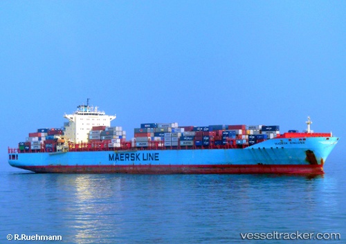
 Maersk Kinloss
Current Status
Where is the vessel?
Maersk Kinloss is currently in 32 nm SE of Geomundo, based on AIS data received about 2h ago.
Latest AIS update:
Current position: 33.66304° N, 127.77242° E (32 nm SE of Geomundo)
Average speed (last 7 days): Loading…
Average speed (last 30 days): Loading…
Vessel profile: Maersk Kinloss is a Container Ship with dimensions 300m x 300m.
This page combines live AIS, route history, probable destination signals, nearby traffic, and port activity for practical vessel monitoring.
The current position of vessel Maersk Kinloss is 33.66304 lat / 127.77242 lng. Updated: 2026-04-09 11:18:25 UTCNearest reference points:
- 35 nm E of Geomundo
- 12 nm E of Geomundo
- 25 nm S of Kukdo
Currently sailing under the flag of USA ![]()
Maersk Kinloss built in 2008 year
Deadweight:
84835 tDetails:
Live Vessel Maersk Kinloss Analytics (details, animations, etc.)
Recent AIS points (UTC):
2026-04-09 06:14:47 UTC · 34.11667, 128.21500 · SOG 6 kn · COG -1°2026-04-09 07:43:05 UTC · 34.00003, 128.13559 · SOG 5 kn · COG -1°
2026-04-09 10:18:31 UTC · 33.77833, 127.89500 · SOG 9 kn · COG -1°
2026-04-09 11:18:25 UTC · 33.66304, 127.77242 · SOG 9.6 kn · COG -1°