 vesseltracker.com
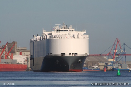
Alliance Norfolk
Current StatusWhere is the vessel?
Alliance Norfolk is currently in Near ISMAILIA, based on AIS data received about 5h ago.
Latest AIS update:
Current position: 30.61548° N, 32.32343° E (Near ISMAILIA)
Average speed (last 7 days): Loading…
Average speed (last 30 days): Loading…
Vessel profile: Alliance Norfolk is a Vehicles Carrier with dimensions 22m x 200m.
This page combines live AIS, route history, probable destination signals, nearby traffic, and port activity for practical vessel monitoring.
The current position of vessel Alliance Norfolk is 30.61548 lat / 32.32343 lng. Updated: 2026-04-10 07:28:15 UTCNearest reference points:
- Near SUEZ CANAL
- Near Port Said East
- Near As Suways (Suez)
Details:
Live Vessel Alliance Norfolk Analytics (details, animations, etc.)
Recent AIS points (UTC):
2026-04-10 02:16:49 UTC · 31.30997, 32.36952 · SOG 6.7 kn · COG 202°2026-04-10 04:02:18 UTC · 31.10092, 32.30857 · SOG 8.4 kn · COG 185°
2026-04-10 05:30:53 UTC · 30.88237, 32.31567 · SOG 8.8 kn · COG 178°
2026-04-10 07:28:15 UTC · 30.61548, 32.32343 · SOG 4.9 kn · COG 203°