 vesseltracker.com
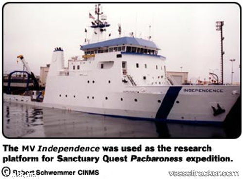
Independence
Current StatusWhere is the vessel?
Independence is currently in Near Hueneme, based on AIS data received about 9d ago.
Latest AIS update:
Current position: 34.15328° N, 119.20997° W (Near Hueneme)
Average speed (last 7 days): Loading…
Average speed (last 30 days): Loading…
Vessel profile: Independence is a Salvage Ship with dimensions 13m x 61m.
This page combines live AIS, route history, probable destination signals, nearby traffic, and port activity for practical vessel monitoring.
The current position of vessel Independence is 34.15328 lat / -119.20997 lng. Updated: 2026-04-03 13:14:54 UTCNearest reference points:
- Near Hueneme
- Near CHANNEL ISLANDS
- Near VENTURA
Details:
Live Vessel Independence Analytics (details, animations, etc.)
Recent AIS points (UTC):
2026-04-03 11:20:53 UTC · 34.15330, -119.21003 · SOG 0 kn · COG 155°2026-04-03 13:14:54 UTC · 34.15328, -119.20997 · SOG 0 kn · COG 155°
2026-04-03 13:14:54 UTC · 34.15328, -119.20997 · SOG 0 kn · COG 155°
2026-04-03 13:14:54 UTC · 34.15328, -119.20997 · SOG 0 kn · COG 155°