 vesseltracker.com
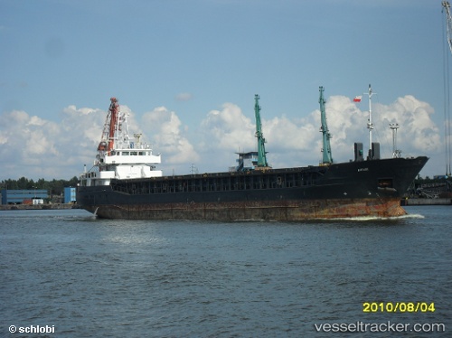
 ENDEAVOUR
Current Status
Where is the vessel?
ENDEAVOUR is currently in 34 nm S of ALANYA, based on AIS data received less than 1h ago.
Latest AIS update:
Current position: 35.98667° N, 31.83667° E (34 nm S of ALANYA)
Average speed (last 7 days): Loading…
Average speed (last 30 days): Loading…
Vessel profile: ENDEAVOUR is a General Cargo with dimensions m x m.
This page combines live AIS, route history, probable destination signals, nearby traffic, and port activity for practical vessel monitoring.
The current position of vessel ENDEAVOUR is 35.98667 lat / 31.83667 lng. Updated: 2026-04-20 21:40:22 UTCNearest reference points:
- Near Kemer
- Near Antalya
- Near Antalya Free Zone
Currently sailing under the flag of Saint Kitts and Nevis ![]()
Details:
Live Vessel ENDEAVOUR Analytics (details, animations, etc.)
Recent AIS points (UTC):
2026-04-20 17:26:15 UTC · 36.00293, 32.59596 · SOG 8.2 kn · COG 273°2026-04-20 18:10:11 UTC · 36.00667, 32.47167 · SOG 8 kn · COG -1°
2026-04-20 18:10:11 UTC · 36.00667, 32.47167 · SOG 8 kn · COG -1°
2026-04-20 21:40:22 UTC · 35.98667, 31.83667 · SOG 8 kn · COG -1°