 vesseltracker.com
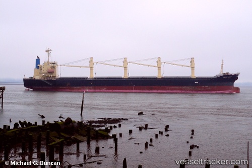
 AYATI
AYATI
Current Status
Where is the vessel?
AYATI is currently in Near Port Sudan, based on AIS data received about 1172d ago.
Latest AIS update:
Current position: 19.60904° N, 37.23186° E (Near Port Sudan)
Average speed (last 7 days): Loading…
Average speed (last 30 days): Loading…
Vessel profile: AYATI is a Bulk Carrier with dimensions 178m x 28m.
This page combines live AIS, route history, probable destination signals, nearby traffic, and port activity for practical vessel monitoring.
The current position of vessel AYATI is 19.60904 lat / 37.23186 lng. Updated: 2023-02-03 21:08:28 UTCNearest reference points:
- Near Port Sudan
- 53 nm SW of SHUAIBAH
- 64 nm W of Tusdeer Free Zone
Currently sailing under the flag of St.Kitts and Nevis ![]()
AYATI built in 1999 year
Deadweight:
35366 tDetails:
Live Vessel AYATI Analytics (details, animations, etc.)
Recent AIS points (UTC):
2023-02-03 21:08:28 UTC · 19.60904, 37.23186 · SOG 0 kn · COG 360°