 vesseltracker.com
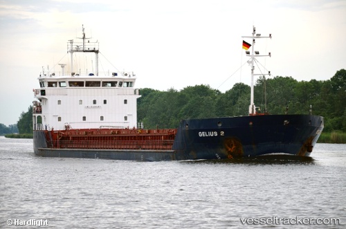
Vessel GELMOND 2 IMO: 9403487, MMSI: 341546000 General Cargo Ship
UTC, 40.84218, 29.23215, course: 59, speed: 0
UTC, 40.84241, 29.23209, course: 72, speed: 0
2026-03-24 21:51:36 UTC, 40.84229, 29.23211, course: 65, speed: 0.1
Live Vessel GELMOND 2 Analytics (details, animations, etc.)
Live AIS position: UTC. Near TUZLA), updated 2026-03-24 21:51:36 UTC.Find the position of the vessel GELMOND 2 on the map. The latter are known coordinates and path.
marine traffic ship tracker show on live map
The current position of vessel GELMOND 2 is 40.84229 lat / 29.23211 lng. Updated: 2026-03-24 21:51:36 UTCCurrently sailing under the flag of St.Kitts and Nevis
GELMOND 2 built in 2008 year
Deadweight:
5492 tDetails:
Last coordinates of the vessel:
UTC, 40.84228, 29.23220, course: 55, speed: 0.1UTC, 40.84218, 29.23215, course: 59, speed: 0
UTC, 40.84241, 29.23209, course: 72, speed: 0
2026-03-24 21:51:36 UTC, 40.84229, 29.23211, course: 65, speed: 0.1