 vesseltracker.com
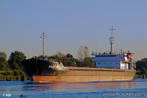
Volaris 52
Current StatusWhere is the vessel?
Volaris 52 is currently in Near Kerch, based on AIS data received about 9h ago.
Latest AIS update:
Current position: 45.31691° N, 36.50437° E (Near Kerch)
Average speed (last 7 days): Loading…
Average speed (last 30 days): Loading…
Vessel profile: Volaris 52 is a General Cargo Ship with dimensions 17m x 140m.
This page combines live AIS, route history, probable destination signals, nearby traffic, and port activity for practical vessel monitoring.
The current position of vessel Volaris 52 is 45.31691 lat / 36.50437 lng. Updated: 2026-04-06 21:47:18 UTCNearest reference points:
- Near Kerch
- Near KOMYSH BURUNSKA
- Near Kavkaz
Details:
Live Vessel Volaris 52 Analytics (details, animations, etc.)
Recent AIS points (UTC):
2026-04-06 20:03:35 UTC · 45.31063, 36.50328 · SOG 57.3 kn · COG 315°2026-04-06 21:47:18 UTC · 45.31691, 36.50437 · SOG 54.8 kn · COG 315°
2026-04-06 21:47:18 UTC · 45.31691, 36.50437 · SOG 54.8 kn · COG 315°
2026-04-06 21:47:18 UTC · 45.31691, 36.50437 · SOG 54.8 kn · COG 315°