 vesseltracker.com
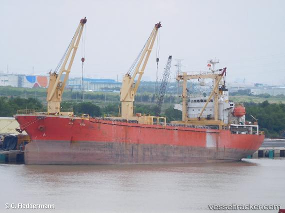
 GREENWAY
Current Status
Where is the vessel?
GREENWAY is currently in Near SUEZ PORT, based on AIS data received less than 1h ago.
Latest AIS update:
Current position: 29.94176° N, 32.55962° E (Near SUEZ PORT)
Average speed (last 7 days): Loading…
Average speed (last 30 days): Loading…
Vessel profile: GREENWAY is a General Cargo with dimensions m x m.
This page combines live AIS, route history, probable destination signals, nearby traffic, and port activity for practical vessel monitoring.
The current position of vessel GREENWAY is 29.94176 lat / 32.55962 lng. Updated: 2026-04-22 07:01:32 UTCNearest reference points:
- Near SUEZ PORT
- Near As Suways (Suez)
- Near Bur Ibrahim
Currently sailing under the flag of Saint Kitts and Nevis ![]()
Details:
Live Vessel GREENWAY Analytics (details, animations, etc.)
Recent AIS points (UTC):
2026-04-22 04:07:34 UTC · 29.94176, 32.55971 · SOG 0 kn · COG 63°2026-04-22 04:37:34 UTC · 29.94177, 32.55968 · SOG 0 kn · COG 63°
2026-04-22 05:55:32 UTC · 29.94178, 32.55964 · SOG 0 kn · COG 63°
2026-04-22 07:01:32 UTC · 29.94176, 32.55962 · SOG 0 kn · COG 63°