 vesseltracker.com
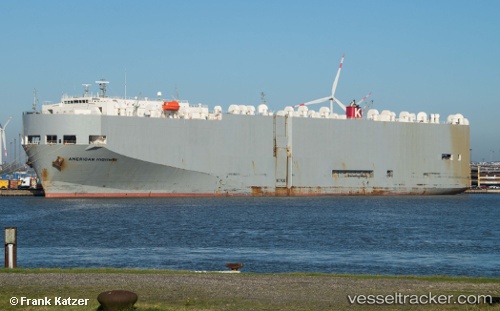
American Highway
Current StatusWhere is the vessel?
American Highway is currently in 259 nm E of Rodrigues, based on AIS data received about 1h ago.
Latest AIS update:
Current position: 19.77996° S, 68.00115° E (259 nm E of Rodrigues)
Average speed (last 7 days): Loading…
Average speed (last 30 days): Loading…
Vessel profile: American Highway is a Vehicles Carrier with dimensions 32m x 180m.
This page combines live AIS, route history, probable destination signals, nearby traffic, and port activity for practical vessel monitoring.
The current position of vessel American Highway is -19.77996 lat / 68.00115 lng. Updated: 2026-04-04 05:14:52 UTCNearest reference points:
- 255 nm E of Rodrigues
- 249 nm E of Rodrigues
Details:
Live Vessel American Highway Analytics (details, animations, etc.)
Recent AIS points (UTC):
2026-04-03 23:03:02 UTC · -19.31084, 69.71443 · SOG 16.4 kn · COG 250°2026-04-04 01:00:46 UTC · -19.46711, 69.17010 · SOG 16.6 kn · COG 255°
2026-04-04 03:22:22 UTC · -19.64277, 68.51006 · SOG 16.1 kn · COG 254°
2026-04-04 05:14:52 UTC · -19.77996, 68.00115 · SOG 15.5 kn · COG 254°