 vesseltracker.com
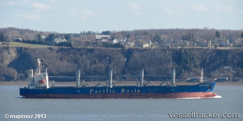
Harmony Ocean
Current StatusWhere is the vessel?
Harmony Ocean is currently in Near Zhangjiagang, based on AIS data received about 15h ago.
Latest AIS update:
Current position: 32.01153° N, 120.36810° E (Near Zhangjiagang)
Average speed (last 7 days): Loading…
Average speed (last 30 days): Loading…
Vessel profile: Harmony Ocean is a Bulk Carrier with dimensions 26m x 177m.
This page combines live AIS, route history, probable destination signals, nearby traffic, and port activity for practical vessel monitoring.
The current position of vessel Harmony Ocean is 32.01153 lat / 120.36810 lng. Updated: 2026-04-10 08:22:17 UTCNearest reference points:
- Near Jingjiang Pt
- Near Zhangjiagang
- Near Jiangyin Pt
Details:
Live Vessel Harmony Ocean Analytics (details, animations, etc.)
Recent AIS points (UTC):
2026-04-10 01:52:27 UTC · 31.67180, 121.19723 · SOG 9.3 kn · COG 309°2026-04-10 03:55:27 UTC · 31.82872, 120.90718 · SOG 8.4 kn · COG 337°
2026-04-10 05:43:27 UTC · 32.01153, 120.74998 · SOG 8 kn · COG 262°
2026-04-10 08:22:17 UTC · 32.01153, 120.36810 · SOG 4.2 kn · COG 243°