 vesseltracker.com
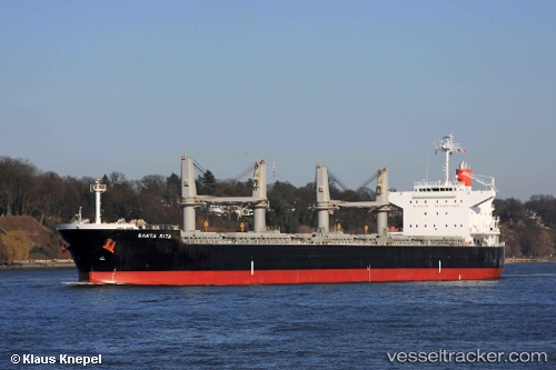
Santa Rita
Current StatusWhere is the vessel?
Santa Rita is currently in Near SEMIRARA, based on AIS data received less than 1h ago.
Latest AIS update:
Current position: 12.06333° N, 121.31333° E (Near SEMIRARA)
Average speed (last 7 days): Loading…
Average speed (last 30 days): Loading…
Vessel profile: Santa Rita is a Bulk Carrier with dimensions 32m x 190m.
This page combines live AIS, route history, probable destination signals, nearby traffic, and port activity for practical vessel monitoring.
The current position of vessel Santa Rita is 12.06333 lat / 121.31333 lng. Updated: 2026-04-09 19:37:30 UTCNearest reference points:
- 19 nm NE of CORON
- 12 nm S of Lobo
- Near Lobo
Details:
Live Vessel Santa Rita Analytics (details, animations, etc.)
Recent AIS points (UTC):
2026-04-09 14:06:52 UTC · 12.06562, 121.31388 · SOG 0 kn · COG 104°2026-04-09 15:42:50 UTC · 12.06516, 121.31393 · SOG 0 kn · COG 93°
2026-04-09 18:22:28 UTC · 12.06333, 121.31333 · SOG 0 kn · COG -1°
2026-04-09 19:37:30 UTC · 12.06333, 121.31333 · SOG 0 kn · COG -1°