 vesseltracker.com
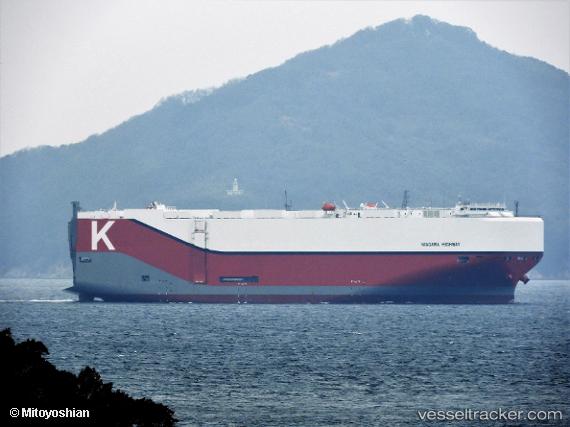
Niagara Highway
Current StatusWhere is the vessel?
Niagara Highway is currently in 251 nm W of Jonesville, based on AIS data received about 1d ago.
Latest AIS update:
Current position: 40.31981° N, 58.76568° W (251 nm W of Jonesville)
Average speed (last 7 days): Loading…
Average speed (last 30 days): Loading…
Vessel profile: Niagara Highway is a Vehicles Carrier with dimensions 37m x 199m.
This page combines live AIS, route history, probable destination signals, nearby traffic, and port activity for practical vessel monitoring.
The current position of vessel Niagara Highway is 40.31981 lat / -58.76568 lng. Updated: 2026-04-10 07:43:21 UTCNearest reference points:
- 260 nm W of Jonesville
- 153 nm NW of Jonesville
Details:
Live Vessel Niagara Highway Analytics (details, animations, etc.)
Recent AIS points (UTC):
2026-04-10 01:25:10 UTC · 40.10768, -60.77596 · SOG 14.9 kn · COG 81°2026-04-10 03:51:45 UTC · 40.18667, -59.99500 · SOG 14 kn · COG -1°
2026-04-10 05:32:07 UTC · 40.24678, -59.47743 · SOG 14.5 kn · COG 79°
2026-04-10 07:43:21 UTC · 40.31981, -58.76568 · SOG 15.7 kn · COG 83°