 vesseltracker.com
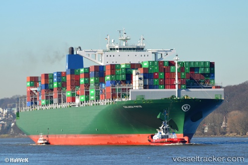
 EVER TOP
Current Status
Where is the vessel?
EVER TOP is currently in 66 nm E of Lü-hua Shan, based on AIS data received about 1h ago.
Latest AIS update:
Current position: 30.93574° N, 123.89093° E (66 nm E of Lü-hua Shan)
Average speed (last 7 days): Loading…
Average speed (last 30 days): Loading…
Vessel profile: EVER TOP is a Container Ship with dimensions 368m x 51m.
This page combines live AIS, route history, probable destination signals, nearby traffic, and port activity for practical vessel monitoring.
The current position of vessel EVER TOP is 30.93574 lat / 123.89093 lng. Updated: 2026-04-13 06:07:38 UTCNearest reference points:
- 56 nm E of Lü-hua Shan
- 44 nm E of Lü-hua Shan
- 86 nm E of Lü-hua Shan
Currently sailing under the flag of Panama ![]()
EVER TOP built in 2014 year
Deadweight:
152343 tDetails:
Live Vessel EVER TOP Analytics (details, animations, etc.)
Recent AIS points (UTC):
2026-04-12 23:42:58 UTC · 29.57299, 123.50941 · SOG 13.5 kn · COG 17°2026-04-13 02:32:03 UTC · 30.16514, 123.77145 · SOG 13.5 kn · COG 15°
2026-04-13 03:55:58 UTC · 30.46515, 123.85995 · SOG 13 kn · COG 349°
2026-04-13 06:07:38 UTC · 30.93574, 123.89093 · SOG 13.2 kn · COG 0°