 vesseltracker.com
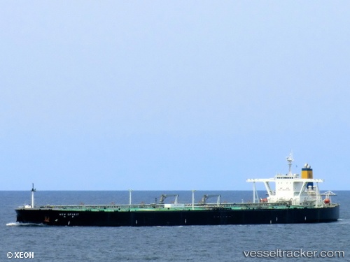
 WEN YAO
Current Status
Where is the vessel?
WEN YAO is currently in Near TANAH MERAH, based on AIS data received about 65d ago.
Latest AIS update:
Current position: 1.25121° N, 104.04054° E (Near TANAH MERAH)
Average speed (last 7 days): Loading…
Average speed (last 30 days): Loading…
Vessel profile: WEN YAO is a Crude Oil Tanker with dimensions 330m x 60m.
This page combines live AIS, route history, probable destination signals, nearby traffic, and port activity for practical vessel monitoring.
The current position of vessel WEN YAO is 1.25121 lat / 104.04054 lng. Updated: 2026-02-15 20:14:22 UTCNearest reference points:
- Near TANAH MERAH
- Near Changi
- Near BATU AMPAR
Currently sailing under the flag of Panama ![]()
WEN YAO built in 2005 year
Deadweight:
298972 tDetails:
Live Vessel WEN YAO Analytics (details, animations, etc.)
Recent AIS points (UTC):
2026-02-15 20:14:22 UTC · 1.25121, 104.04054 · SOG 10.3 kn · COG 85°