 vesseltracker.com
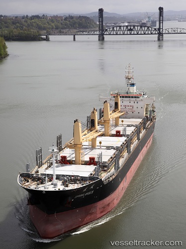
 SUNNY HONG
Current Status
Where is the vessel?
SUNNY HONG is currently in 97 nm N of Fukagawa, based on AIS data received about 1h ago.
Latest AIS update:
Current position: 37.17397° N, 139.04367° W (97 nm N of Fukagawa)
Average speed (last 7 days): Loading…
Average speed (last 30 days): Loading…
Vessel profile: SUNNY HONG is a Bulk Carrier with dimensions m x m.
This page combines live AIS, route history, probable destination signals, nearby traffic, and port activity for practical vessel monitoring.
The current position of vessel SUNNY HONG is 37.17397 lat / -139.04367 lng. Updated: 2026-04-19 06:03:34 UTCCurrently sailing under the flag of Panama ![]()
Details:
Live Vessel SUNNY HONG Analytics (details, animations, etc.)
Recent AIS points (UTC):
2026-04-18 23:24:22 UTC · 38.00985, -140.32587 · SOG 11.6 kn · COG 122°2026-04-19 01:53:32 UTC · 37.69661, -139.84212 · SOG 11.9 kn · COG 122°
2026-04-19 03:39:57 UTC · 37.47986, -139.49219 · SOG 12 kn · COG 123°
2026-04-19 06:03:34 UTC · 37.17397, -139.04367 · SOG 11.8 kn · COG 129°